AUDIO COMMENTARY
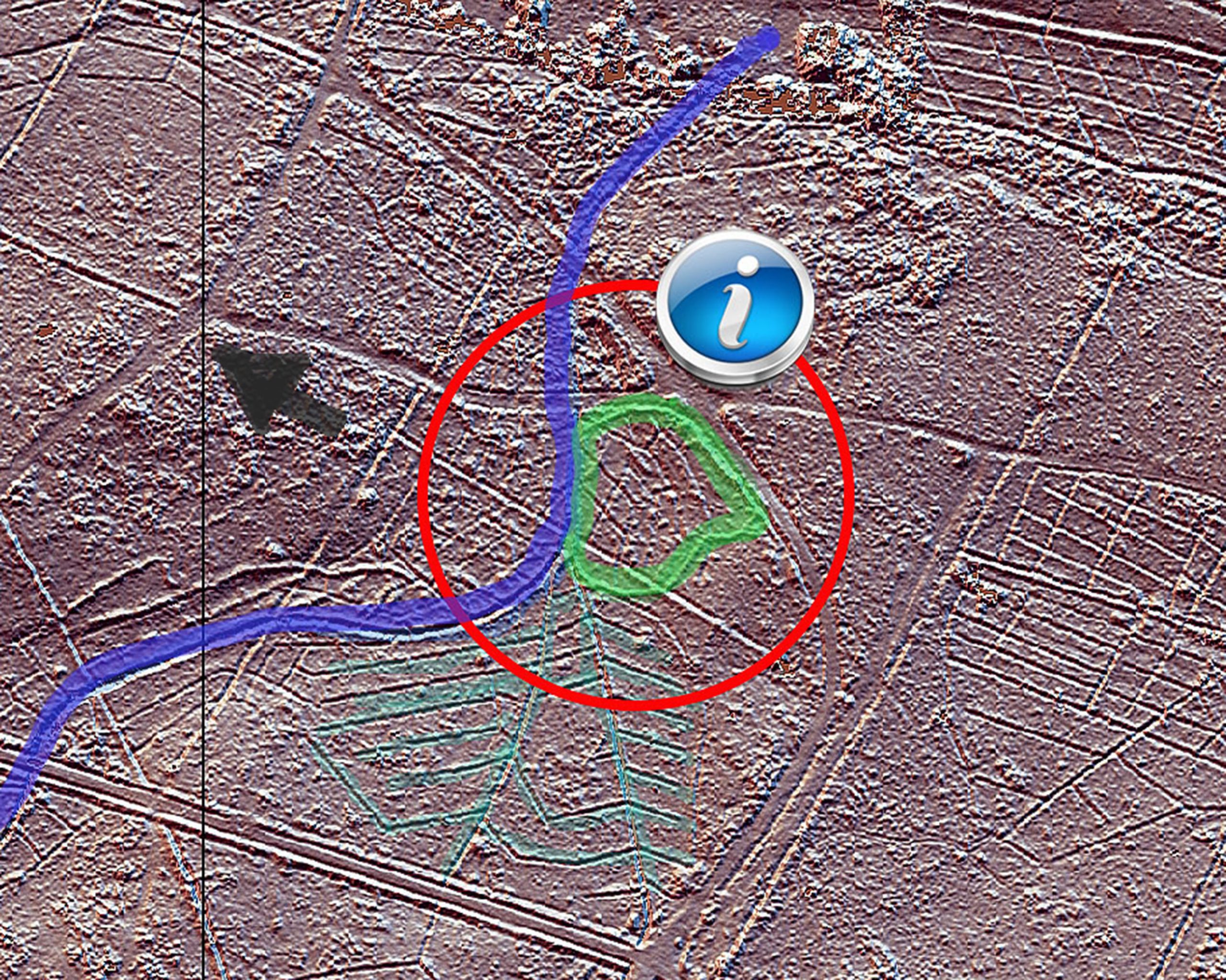
LIDAR mapping of the pond area – “Light Detection and Ranging”, or LiDAR, has changed the face of archaeology by making it possible to measure and map objects and structures that might otherwise remain hidden. Mapping with light. Lidar directs hundreds of thousands of pulses of light toward the ground. It penetrates the tree cover and initial ground layer to expose features impossible to see from the ground.